Freiberg – Roter Graben
Characteristics and Location
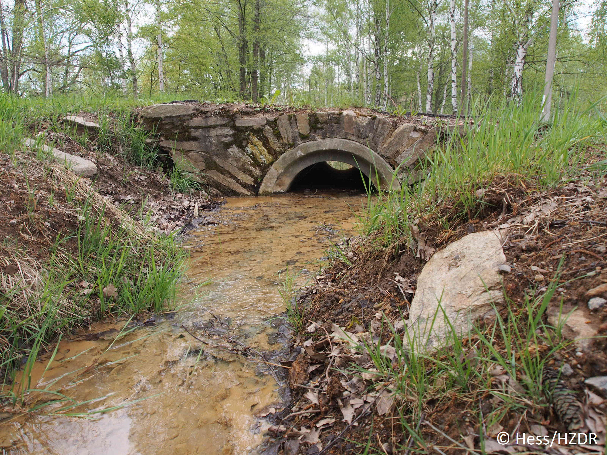
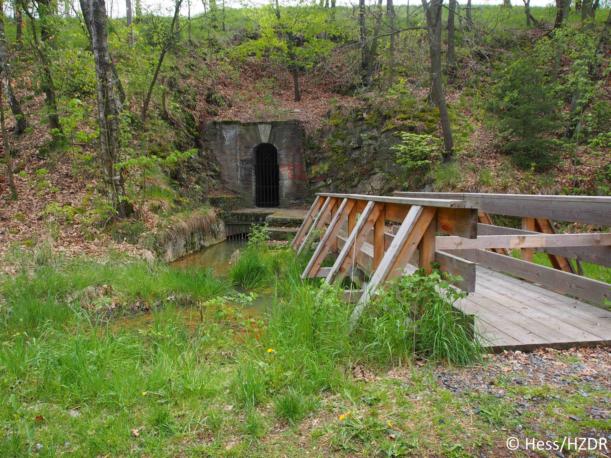
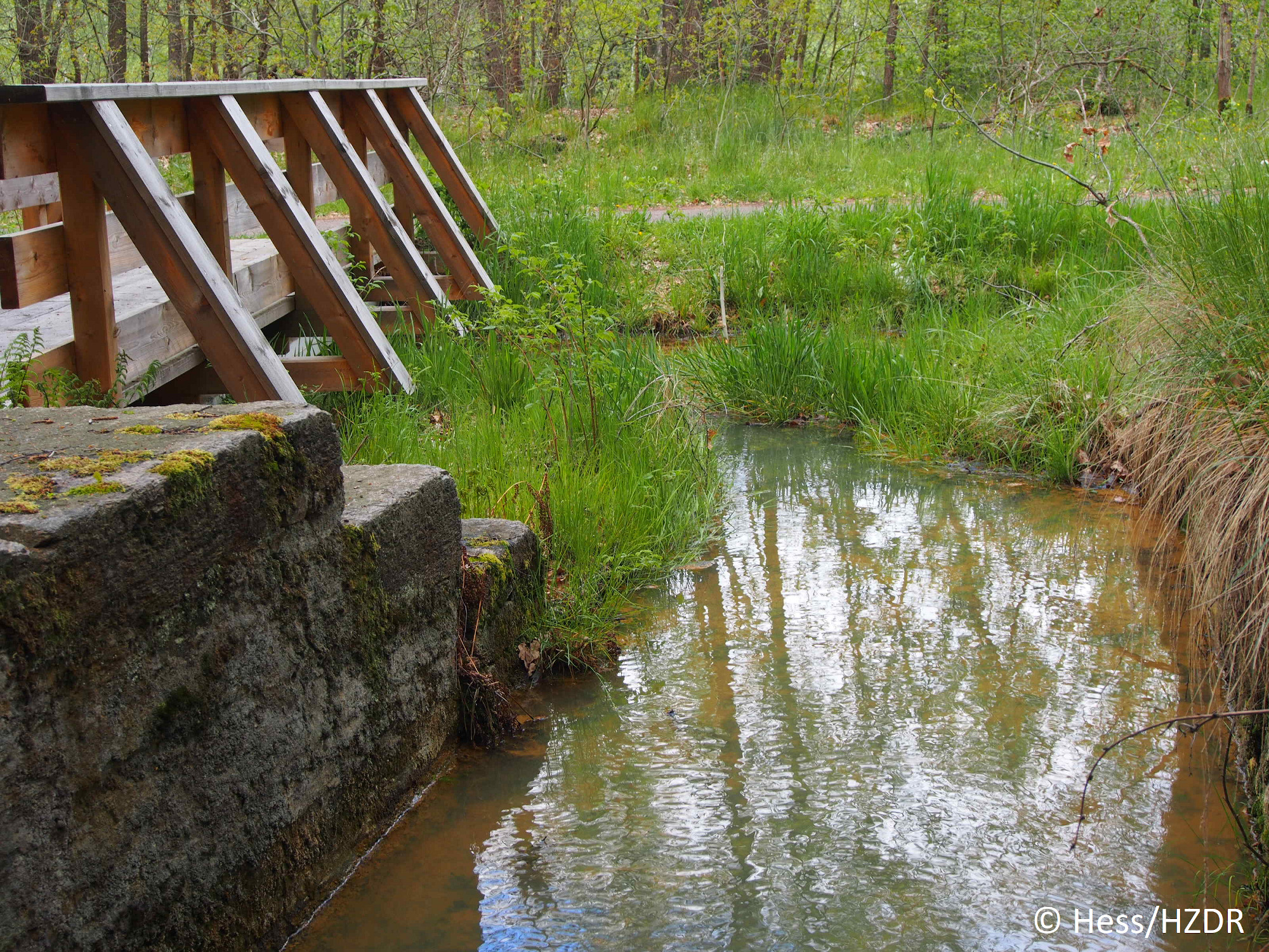
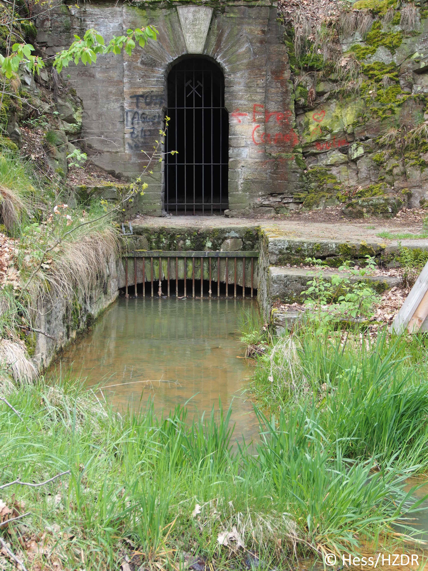
As a branch of the drainage ditch of the Mittlere Ratsmühle north of Halsbach, the Rote Graben is fed by the water of the Freiberger Mulde. Running along the west side of the Freiberg Mulde, it passes the mouth of the Königl. Verträglicher Gesellschaft tunnel to the north. It receives mine water flowing out of this tunnel. The red ditch also passes the mouth of the Thurmhof Hilfsstolln and the main gallery of the Alter Tiefen Fürstenstolln and in turn collects their mine water
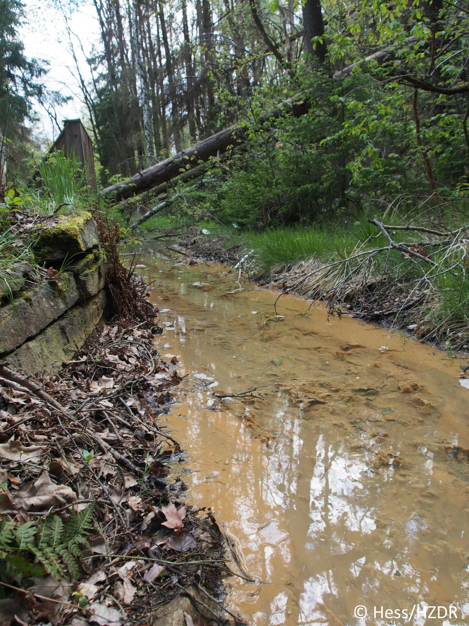
It is fed into the Freiberger Mulde via several surcharges. The name refers to the red, iron-rich precipitates in the ditch. The red ditch is currently heavily silted up.
The Rote Graben contains approx. 13,000 m3 of ferrous sludge. As the ditch is leaking, there is a risk of heavy metal contamination for the groundwater. Surface water is also at risk from the red ditch if the ditch overflows. If the Mulde floods, there is a risk of ditch sediments being mobilized and retaining walls being torn away. This means that the red ditch endangers the soil along the banks of the Freiberger Mulde in the event of flooding.
History
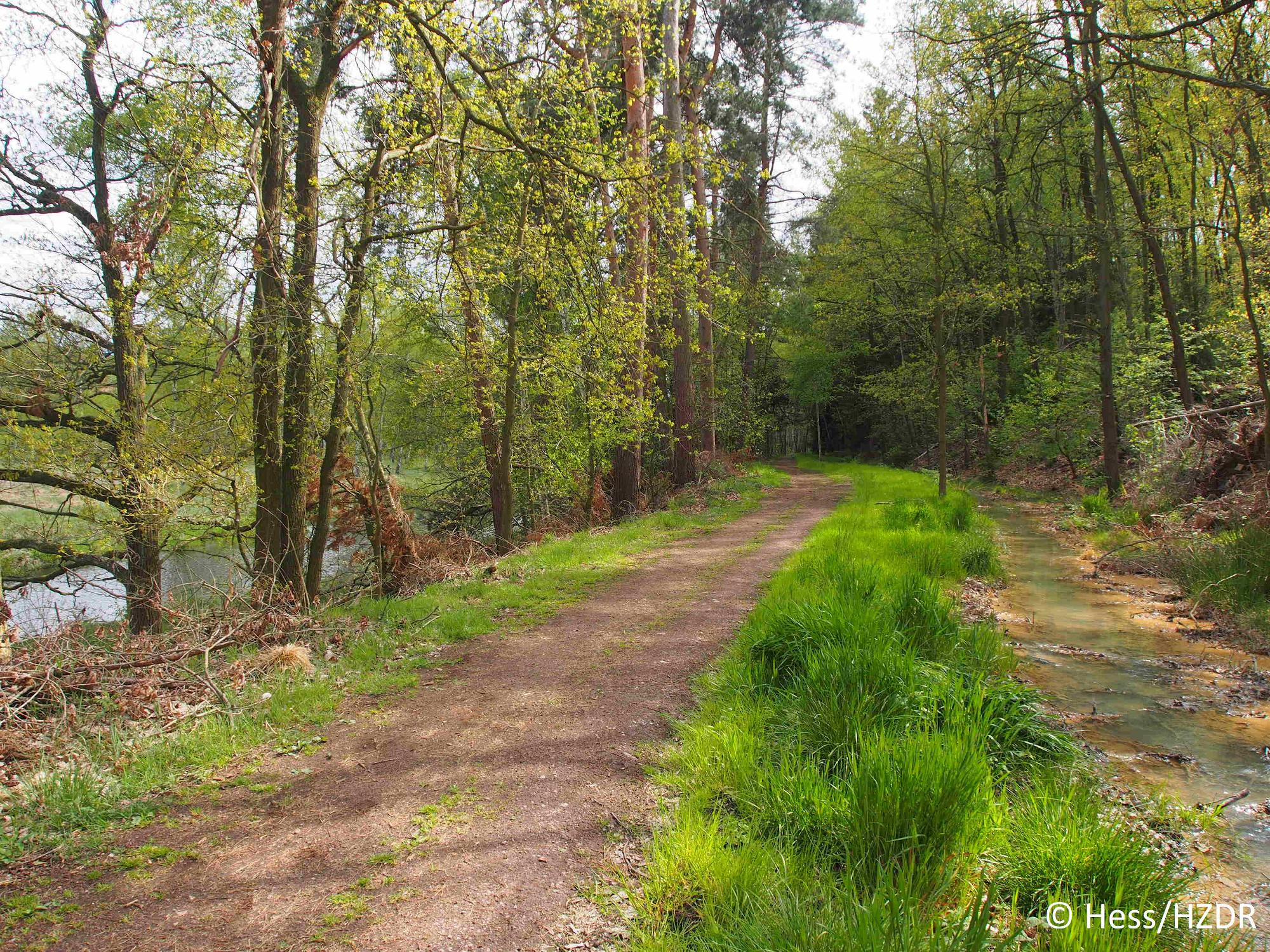
Over part of its length, the water-bearing ditch nowadays has various slopes into the Freiberger Mulde, some of which are stabilized by considerable retaining walls. In the Halsbrücke area, the Rote Graben has been partially eroded.
Since the route from the Roter Graben in Halsbrücke corresponds to the route from the Bergmannsweg, it is a popular hiking trail today.
The Roter Graben is a UNESCO World Heritage Site since 2019.
Projects and activities on Roter Graben
- Project ZAUBER: “Future materials from mining sludge” as part of the funding measure “recomine – resource-oriented environmental technologies for the 21st century”, project coordination: Institute for Technical Chemistry, TUBAF Freiberg, est. 2021-2023
Contact

Philipp Büttner
+49 351 260 4417
p.buettner@hzdr.de
See on the map
Roter Graben on Google Maps
Further links (German)
Greif, A. (2013): The Ore Mountains and the Mulde: Aspects of arsenic and heavy metal transfer.
Article about the Roter Graben in "Unknown Mining"
The Roter Graben Valley in the "MontE" database
The Roter Graben in Wikipedia
Objects of investigation
- Fe- and Al-rich, hydroxydic mud
- Mine water
Pollutants
Cd
Pb
Cu
Zn
Fe
Al
Resources
Fe
Zn
Cu
Pb
Al
Projects
Social Works
Development sites:
Ehrenfriedersdorf
Freiberg - Davidschacht
Freiberg - Roter Graben
Muldenhütten
Term: 01.01.2020 to 31.10.2022
Analysis of decision-making structures and conflicts and development of a methodological toolkit for transdisciplinary...
Our lead partner: ![]()
ZauBer
Development sites:
Freiberg - Roter Graben
Term: From 01.01.2022 to 30.11.2024
Future Materials from Mining Sludge
Our lead partner:
![]()
VeharstGlass
Development sites:
Ehrenfriedersdorf
Freiberg - Davidschacht
Freiberg - Roter Graben
Muldenhütten
Duration: From 01.04.2023 to 31.12.2025
Our lead partner:![]()